The Geometry of the Grid: How Manhattanhenge Became a Digital Spectacle
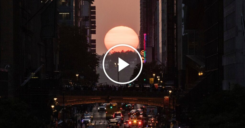
Table of Contents
When the Grid Aligns
For a few fleeting minutes each year, the chaotic sprawl of New York City yields to a precise, mathematical alignment. Manhattanhenge occurs when the setting sun aligns perfectly with the east-west street grid, creating a corridor of golden light that transforms the concrete jungle into a fleeting solar observatory. While the event is rooted in basic astronomy, its modern iteration has become a high-stakes exercise in digital coordination and computational photography.
The phenomenon is a direct result of the Commissioners’ Plan of 1811, which imposed a rigid rectangular grid on the island of Manhattan. Because the grid is not perfectly aligned with the cardinal directions—tilting slightly to the north—the sun only hits this exact perpendicular angle twice a year, typically in late May and mid-July. This year, crowds flooded the cross-town streets, not just to witness the light, but to capture it for a global audience in real-time.
The Digital Rush and ‘The Shot’
What was once a curiosity for local residents has evolved into a viral event. The modern Manhattanhenge is as much about the image as it is about the experience. With the rise of high-dynamic-range (HDR) imaging and AI-driven noise reduction in smartphones, the challenge for photographers has shifted from technical execution to positioning. To get the ‘perfect shot,’ participants now rely on precise GPS coordinates and timing apps that predict the exact second of alignment.
The sheer density of people attempting to capture the moment has created a new urban tension. Logistics that once handled standard commuter traffic now have to contend with thousands of tripod-wielding enthusiasts blocking intersections. This intersection of celestial timing and social media pressure highlights a broader trend in digital culture: the ‘Instagrammability’ of urban geography, where a physical location is valued primarily for its ability to produce a viral visual asset.
The Science of the Sightline
From a technical perspective, Manhattanhenge is a study in urban optics. The towering skyscrapers of Midtown act as shutters, narrowing the field of view and intensifying the perceived brightness of the solar disk. This creates a natural ‘pinhole’ effect that amplifies the golden hour glow, making the light feel more visceral than it would in an open landscape.
For the tech-savvy, the event serves as an informal stress test for mobile networks. As thousands of users simultaneously upload 4K video and high-resolution bursts to platforms like TikTok and Instagram, the localized cellular demand spikes, often leading to temporary network throttling in the most congested corridors of the city.
The Evolution of the Urban Event
The transition of Manhattanhenge from a quirk of geography to a digital milestone reflects how we interact with our cities. We no longer simply inhabit the grid; we map it, optimize it, and broadcast it. The event demonstrates a symbiotic relationship between the rigid planning of the 19th century and the fluid, algorithmic distribution of the 21st. As camera sensors continue to evolve, the way we document these brief alignments will likely move toward augmented reality, where the exact trajectory of the sun can be overlaid on a viewfinder, removing the guesswork from the hunt for the perfect angle.