Satellite Imaging and Robotics Race Against Time in Venezuela Earthquake Recovery
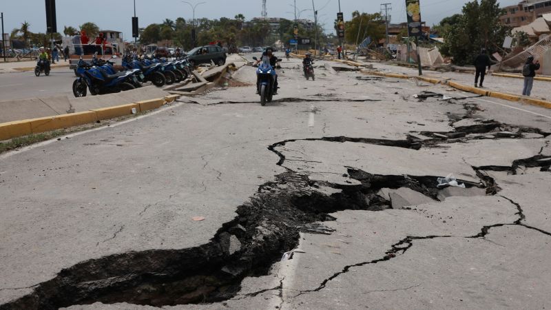
Table of Contents
The Precision Race Against the ‘Golden Window’
In the wake of twin earthquakes that have left approximately 235 people dead across La Guaira and Caracas, the focus of international relief efforts has shifted from immediate shock to the critical ‘golden window.’ In disaster forensics, this window represents the first 72 hours where the probability of finding survivors beneath concrete slabs and twisted rebar is highest. However, the scale of destruction in Venezuela’s urban centers has rendered traditional search-and-rescue patterns insufficient.
Rescuers are now leaning heavily on a combination of synthetic aperture radar (SAR) and high-resolution satellite imagery to map the devastation. Unlike standard optical satellites, SAR can penetrate cloud cover and smoke, allowing coordinators to identify ‘structural anomalies’—areas where buildings have pancaked or shifted—without needing ground-level visibility. This data is being fed into geospatial platforms to prioritize deployment zones, ensuring that US military personnel and international teams aren’t wasting precious hours searching stable ruins when survivors are likely trapped in specific, identified collapse zones.
Robotics and the Challenge of Urban Rubble
The logistical nightmare in La Guaira and the surrounding capital region is compounded by the nature of the rubble. Many of the collapsed structures were not built to modern seismic codes, resulting in unstable debris piles that are too dangerous for human rescuers to enter. This has led to the deployment of specialized robotic tools, including snake-bots and acoustic sensors capable of detecting heartbeats or faint scratching sounds through several meters of concrete.
These tools are essential because the second quake—the most powerful the country has seen in over a century—created a ‘secondary collapse’ effect. This means survivors who may have been reachable after the first tremor were buried deeper or trapped by falling debris during the second shock. Thermal imaging drones are currently being utilized to scan for heat signatures in the ruins, though their effectiveness is often hampered by the high ambient temperature of the region and the insulating properties of thick concrete debris.
Geopolitical Friction and Technical Coordination
The deployment of high-tech aid is occurring against a backdrop of extreme political tension. The presence of US military assets on the ground is a stark contrast to the hostilities seen earlier this year during special forces operations targeting the Maduro administration. The current mission is purely humanitarian, but the coordination of data sharing between foreign relief agencies and the Venezuelan government remains a bottleneck.
For the rescue effort to succeed, there must be a seamless integration of the secure communication protocols used by international teams and the local infrastructure. In many affected areas, cellular networks are entirely offline, forcing rescuers to rely on satellite-linked Mesh networks to maintain a common operating picture (COP). Without this digital layer, the movement of heavy machinery and medical triage units remains fragmented, potentially slowing the rescue rate as the golden window begins to close.