Dark Ships and Digital Silence: How GPS Spoofing is Masking the Hormuz Blockade
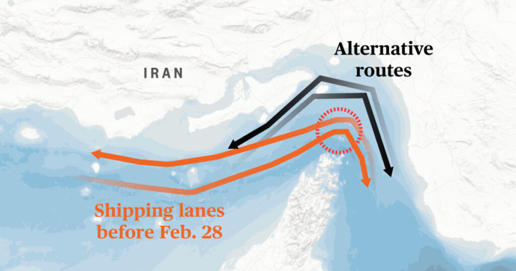
Table of Contents
The Invisible Armada
On the surface, the satellite maps of the Strait of Hormuz show a ghostly emptiness. For weeks, the narrow waterway—once a bustling artery for 20% of the world’s oil and natural gas—has appeared nearly dormant. But the reality on the water is far more complex than what is appearing on the screens of maritime trackers. A growing trend of ‘dark shipping’ and sophisticated GPS manipulation is currently masking the true scale of the transit crisis.
Following the U.S.-Israeli strikes on February 28 and the subsequent Iranian retaliatory measures, the Strait has become a digital battleground. While official counts of ships passing through the waterway have plummeted, industry insiders suggest the numbers are skewed by a surge in AIS (Automatic Identification System) manipulation. Shipping companies, desperate to avoid the tolls demanded by Tehran or the risk of becoming targets in the crossfire, are increasingly engaging in ‘spoofing’—altering their GPS coordinates to appear as if they are in a different location or simply vanishing from the map entirely.
The Mechanics of Digital Stealth
AIS is the global standard for vessel tracking, relying on VHF radio to transmit a ship’s identity, position, and speed. However, the system was never designed for wartime environments. By using software-defined radios (SDRs) or simply disabling the transponders, vessels can effectively ‘go dark.’
In the current Hormuz deadlock, this has created a data vacuum. When Iran’s Islamic Revolutionary Guard Corps (IRGC) Navy published maps of ‘safe’ inbound and outbound routes, it wasn’t just a navigational aid—it was a signaling mechanism. Ships that follow these corridors often maintain their signals, while those attempting to bypass the blockade or evade Iranian tolls frequently employ spoofing techniques to confuse coastal surveillance.
Energy Markets and the Data Gap
The economic fallout of this digital opacity is being felt at the pump. U.S. gas prices surged over 40% in March, breaching the $4 per gallon mark as markets reacted to the perceived total closure of the Strait. While prices saw a brief dip in April, May has brought new highs, driven in part by the uncertainty of the actual supply volume.
The problem for analysts and economists is that the ‘real’ number of tankers is currently an estimate. When a vessel manipulates its GPS, it creates a blind spot in the global energy supply chain. This lack of verifiable data leads to market volatility; traders cannot tell if the oil flow has truly stopped or if it has simply moved into the shadows. This ‘information asymmetry’ allows geopolitical tensions to drive price spikes more aggressively than the actual physical shortage might dictate.
A New Era of Maritime Cybersecurity
The situation in Hormuz highlights a critical vulnerability in maritime technology. The reliance on unencrypted, unauthenticated AIS signals means that any actor with basic radio equipment can forge a ship’s identity or location. As the IRGC continues to suggest the potential deployment of sea mines, the risk for ships that cannot verify their position relative to these hazards increases.
For the shipping industry, the crisis is forcing a pivot toward more secure, proprietary tracking systems and a heavier reliance on satellite synthetic aperture radar (SAR), which can ‘see’ ships regardless of whether their GPS is active. Until a diplomatic resolution is reached, the Strait of Hormuz remains not just a geopolitical chokepoint, but a cautionary tale about the fragility of the digital systems that govern global trade.