The High-Frequency Pivot: How Satellite Intelligence is Replacing Static Border Patrols
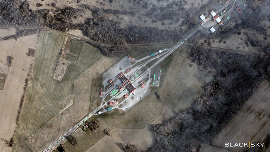
Table of Contents
The End of the Static Border
For decades, border security has been a game of attrition—static fences, intermittent patrols, and sensor arrays that alert agencies to a breach only after it has occurred. But as migration patterns shift and organized facilitation networks become more agile, the traditional ‘line in the sand’ approach is failing. Across Europe, border environments are no longer static; they are fluid systems where staging areas disperse and vehicle concentrations shift in a matter of hours.
The bottleneck for national security organizations and ministries of interior is no longer a lack of data, but a lack of tempo. In the current intelligence landscape, the gap between observing an anomaly and deploying a response is where security failures happen. This is driving a pivot toward commercial space-based intelligence, where the goal is no longer just ‘seeing’ a location, but compressing the decision cycle to a near-instantaneous timeframe.
Beyond the Snapshot: The Rise of High-Frequency Revisits
Standard satellite imagery has historically provided a snapshot—a high-resolution look at a place at a specific moment. However, for tactical border commanders, a snapshot is often obsolete by the time it is processed. If a group of vehicles gathers near a non-transit corridor at 08:00, but the imagery isn’t analyzed until 14:00, the window for interception has likely closed.
Companies like BlackSky are attacking this latency by deploying constellations designed for high-frequency revisits. By orbiting in a way that allows for hourly or daily captures of the same coordinate, these systems transform satellite data from a series of photos into a continuous stream of intelligence. When combined with AI-enabled analytics, the system doesn’t just deliver an image; it delivers a notification. Automated object detection can now flag the sudden appearance of temporary encampments or the unusual movement of small maritime vessels outside established shipping lanes without requiring a human analyst to manually scan thousands of square kilometers of terrain.
Pattern-of-Life and Operational Resource Allocation
While the tactical gain is immediate detection, the operational advantage lies in ‘pattern-of-life’ analysis. By aggregating high-cadence data over weeks, security agencies can identify the infrastructure of facilitation networks—the recurring logistics nodes and predictable cycles of movement that suggest a long-term operation rather than a random crossing.
This shift allows for a proactive reallocation of resources. Rather than reacting to a breach reported by a ground sensor, commanders can see pressure points building in real-time. If AI analysis indicates a sustained increase in vehicle concentrations at a specific coastal approach, assets can be repositioned before the area becomes overwhelmed. This moves the operational posture from reactive to predictive, effectively using orbital data to shape the physical environment on the ground.
The Strategic Calculus of Orbital Intelligence
At the highest levels of governance, the integration of low-latency satellite intelligence changes the diplomatic and strategic calculus. Understanding how routes evolve and how networks adapt to previous interventions provides policymakers with a layer of certainty that fragmented ground reports cannot offer.
The transition to commercial providers is also a matter of accessibility. Governments are increasingly relying on the agility of private constellations that can be task-directed quickly, bypassing the bureaucratic lag often associated with legacy government satellite programs. In an environment where activity shifts with extreme volatility, the ability to task a satellite and receive analyzed data within a narrow window is no longer a luxury—it is a strategic necessity.
As AI continues to refine the classification of objects from orbit, the boundary between ‘intelligence’ and ‘action’ will continue to blur, turning the sky into the primary sensor for ground-level security.