The ‘Super’ El Niño Warning: Why 2026’s Pacific Warming is a Climate Collision Course
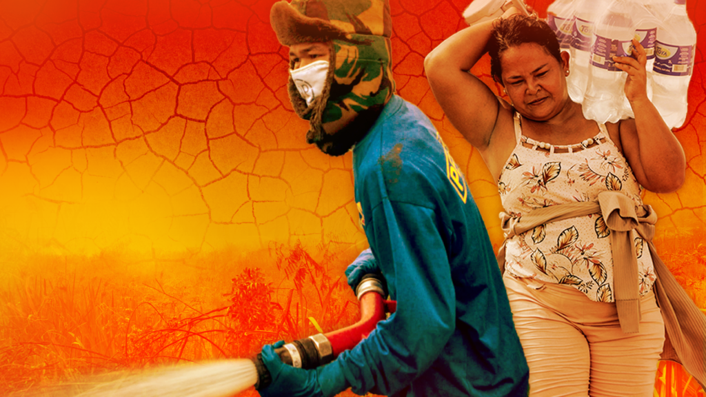
Table of Contents
A Pattern Shift in the Pacific
The World Meteorological Organization (WMO) has issued a stark warning that a new phase of the El Niño weather pattern is imminent, with the potential to become one of the most powerful events ever recorded. While El Niño is a recurring natural phenomenon, the convergence of this cycle with a planet already strained by anthropogenic climate change is creating a volatile atmospheric cocktail.
The shift has been tracked through a dramatic transformation in the central Pacific. In December, monitoring regions showed cooler-than-average waters. By March, the trend reversed, with warmer waters emerging off the South American coast. By April, the warming was unmistakable, and temperatures have continued to climb steadily into the summer months.
The Mechanics of a ‘Super’ Event
An El Niño event is triggered when a shift in wind patterns allows warm surface waters to migrate across the tropical Pacific. While a standard event is noted when temperatures rise 0.5°C above the baseline, a ‘super’ El Niño—a rarity since 1950—occurs when warming exceeds 2.0°C.
The evidence for an extreme event isn’t just on the surface. Data from satellites and ocean floats indicate a massive wave of warm water, measuring more than 6°C above average in certain pockets, creeping eastward beneath the ocean surface. According to Michelle L’Heureux of NOAA’s Climate Prediction Center, this deep-sea heat is a critical precursor. When this warmth reaches the surface, it heats the air above, fundamentally disrupting global jet streams and precipitation patterns.
Compounding the Climate Crisis
The primary concern for climatologists is not just the El Niño event itself, but the baseline upon which it is occurring. We are no longer dealing with natural cycles in a stable environment; we are layering a powerful warming event onto a planet that has already seen a significant rise in average global temperatures.
“El Niño conditions will pour fuel on the fire of a warming world,” UN Secretary-General António Guterres stated, noting that the resulting impacts will likely travel farther and strike with greater speed than in previous decades.
Zeke Hausfather of the Berkeley Earth group suggests that 2027 is already positioned to be the warmest year on record. To put this in perspective, Hausfather notes that the massive 1998 El Niño event—which was an incredibly hot year for its time—would be considered an “incredibly cold year” compared to the last two decades of human-driven warming.
Global Ripple Effects and Economic Risk
While no two El Niño events are identical, the historical footprint of a strong event is predictable in its devastation. Typical patterns include:
- Severe Droughts: Increased risk of wildfires and water scarcity in Southeast Asia, Australia, and parts of South America.
- Agricultural Failure: Weakened Indian monsoons and dry conditions in the Greater Horn of Africa, which directly threaten food security.
- Extreme Precipitation: Heavier rainfall and increased flooding risks across the southern United States.
These meteorological shifts translate directly into economic instability. Past events have triggered sharp spikes in global food prices and trillions of dollars in lost income as crop failures disrupt international supply chains.
The Variable Factor
Despite the confidence of the UK Met Office and NOAA, there remains a significant wildcard: wind patterns. Because El Niño is highly sensitive to atmospheric shifts that are difficult to predict months in advance, scientists cannot yet definitively label this a record-breaker. However, the consensus remains that even a moderate event in the current climate era will produce results far more extreme than the historical averages suggest.