Google Earth Updates Reveal the Systematic Erasure of Southern Gaza’s Urban Fabric
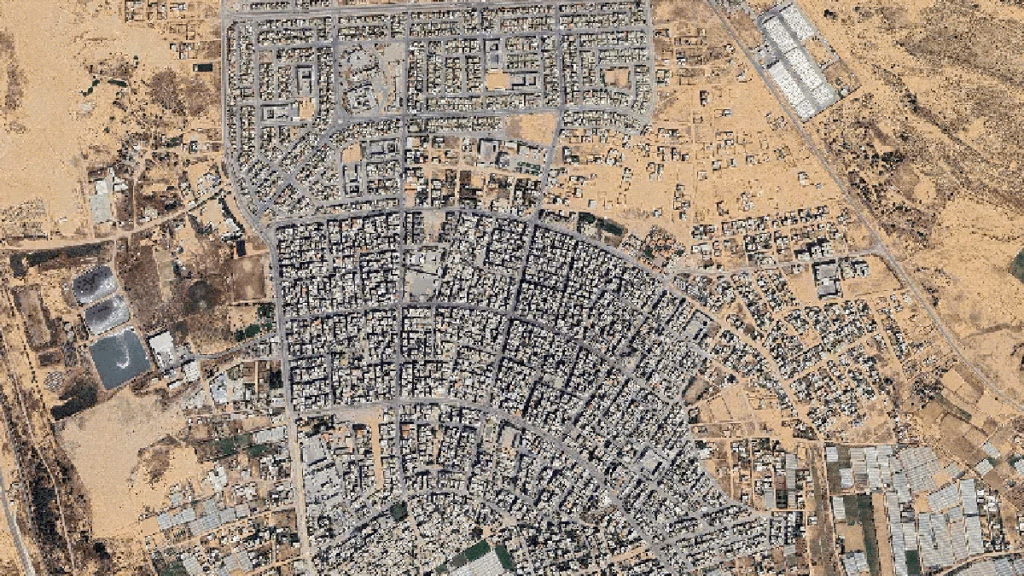
Table of Contents
The Digital Record of Physical Erasure
The latest high-resolution satellite imagery integrated into Google Earth provides a stark, forensic look at the changing geography of the Gaza Strip. Captured on February 25, 2026, the data reveals that the conflict has moved beyond tactical engagement into what appears to be a systematic dismantling of the region’s urban and civic infrastructure.
For those on the ground, the maps are more than just data points; they are evidence of a vanished way of life. Palestinian journalist Muhannad Qishta, seeking the graves of his sisters in Khan Younis, discovered through these digital updates that the Sheikh Mohammed cemetery in the Maan area has been effectively wiped from the map. In its place, the imagery shows the geometric patterns of Israeli military outposts, characterized by armored vehicles and temporary tent structures.
Mapping the Collapse of Residential Hubs
The scale of destruction in Rafah and Khan Younis is no longer just a matter of anecdotal reporting but is now verifiable through geospatial analysis. In Rafah, the ‘Saudi neighborhood’ in Tal as-Sultan—once a sprawling 752-unit housing project—has been reduced to a series of monochromatic rubble mounds. The imagery shows an urban footprint that has been almost entirely erased, with only the faint, ghostly outlines of former street grids remaining.
Similarly, the ‘Swedish village’ in Rafah, a coastal community founded in 1965 to support 1,300 refugees, has transitioned from a vibrant fishing hub to a restricted military zone. Where beachfront commercial stalls and community centers once stood, the satellite view now reveals an Israeli outpost with only five residential structures still intact. The Rafah border crossing, previously the primary civilian artery for the besieged territory, has seen its passenger halls and logistics facilities replaced by fortified observation posts and extensive razor-wire perimeters.
Institutional and Agricultural Devastation
The erasure extends to the intellectual and economic foundations of the territory. The satellite data confirms the total leveling of the Islamic University of Gaza and Al-Azhar University, both of which served tens of thousands of students. These campuses were not merely damaged by crossfire but appear to have been targeted by controlled military detonations, leaving nothing but cleared plots of land.
The impact on food security is equally visible from orbit. The agricultural heartlands of southern Gaza, once dominated by greenhouses producing 40% of the Strip’s daily food needs, have been systematically razed. In the Shakoush area, imagery shows the removal of topsoil and the flattening of greenhouses by bulldozers, a process that the UN Food and Agriculture Organization (FAO) notes has left less than 5% of the land usable.
The Logistics of Displacement
The imagery also tracks the movement of the surviving population. As residential blocks in Bani Suhaila, Abasan, and al-Zana were demolished to create military supply lines, thousands were pushed toward the coast. This is evidenced by the sudden, dense proliferation of makeshift encampments in al-Mawasi, where white tent clusters now spill onto the Mediterranean shores in an attempt to escape the expanding military zones.
Hamad City, a $135 million Qatari-funded project designed to provide 3,000 modern housing units for low-income families, is now a skeletal ruin. The contrast between the project’s original architectural intent and its current state—a shell of concrete surrounded by displaced families—underscores the total collapse of the region’s planned urban development.